25th February, 2020
Now, we had had a bit of a problem about getting to Milford Sound. The original plan had been to drive there and we had booked a cruise up and down the Sound. Unfortunately there had been a lot of rain in the area in early February (and I mean a LOT of rain) and the River Eglington that runs along SH94, the only road in and out had severely damaged the road with land slips and bridges out and all sorts. So the road was closed to normal traffic. Luckily though we managed to cancel our original booking and book instead on a minibus tour as they were allowing convoys of buses to and from MS at regular intervals (thus allowing the road workers to carry on uninterrupted in between convoys).
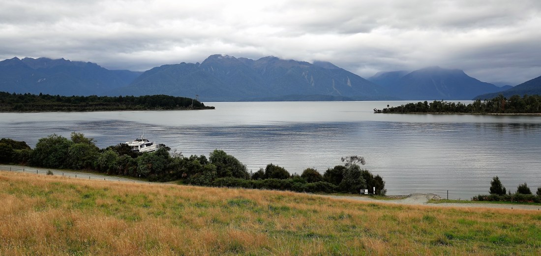
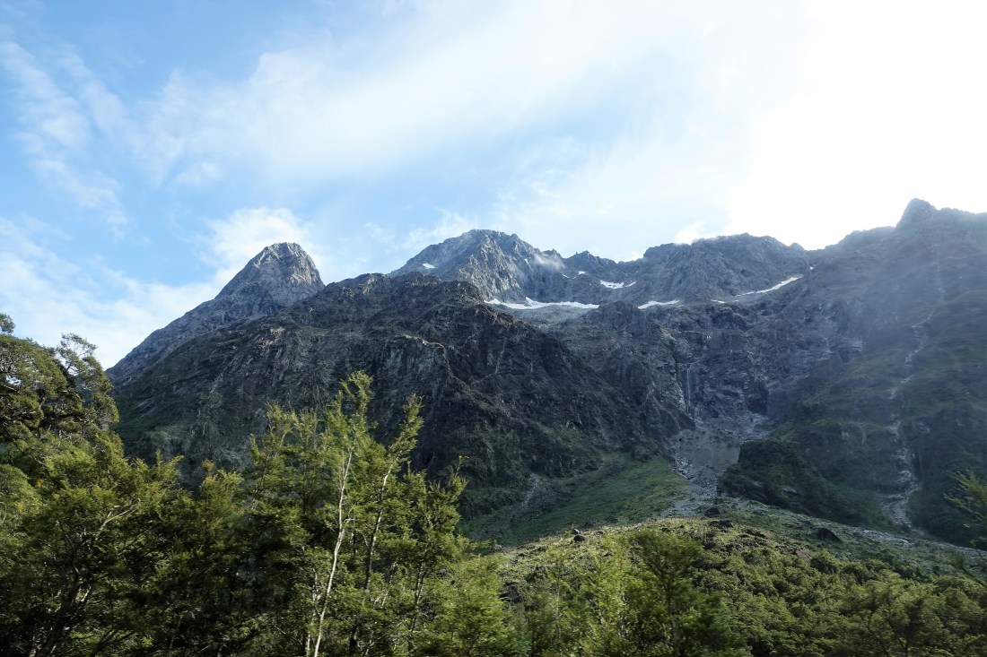
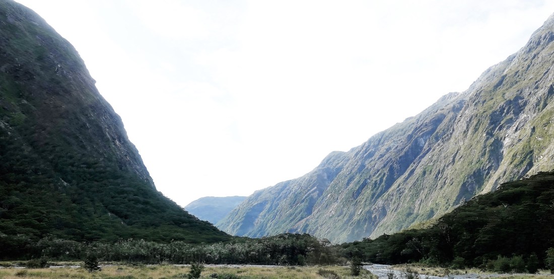
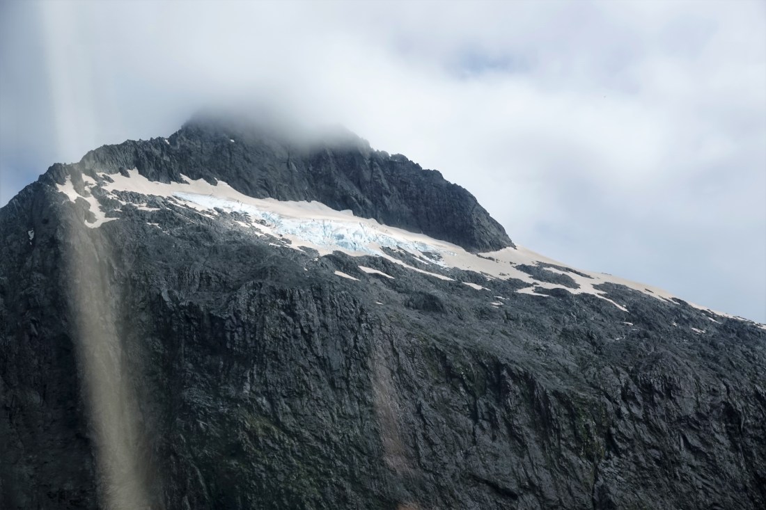
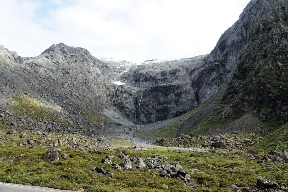
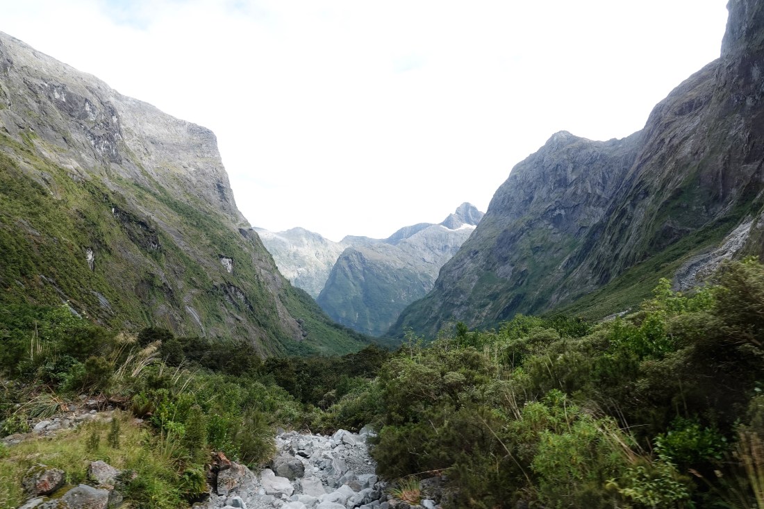
So it was up early for a 7.10 am start and into our bus for a fabulous drive through yet more stunning scenery. It was a bit cloudy, but as it was supposed to be raining according to the forecast, we were happy enough. The driver had to take us to the point where the buses queued for the convoy, so we had a bit of time for a few stops en route with views such as these…
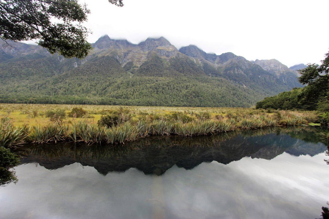
We did have one more stop at the Mirror Lakes, named for the obvious reason….
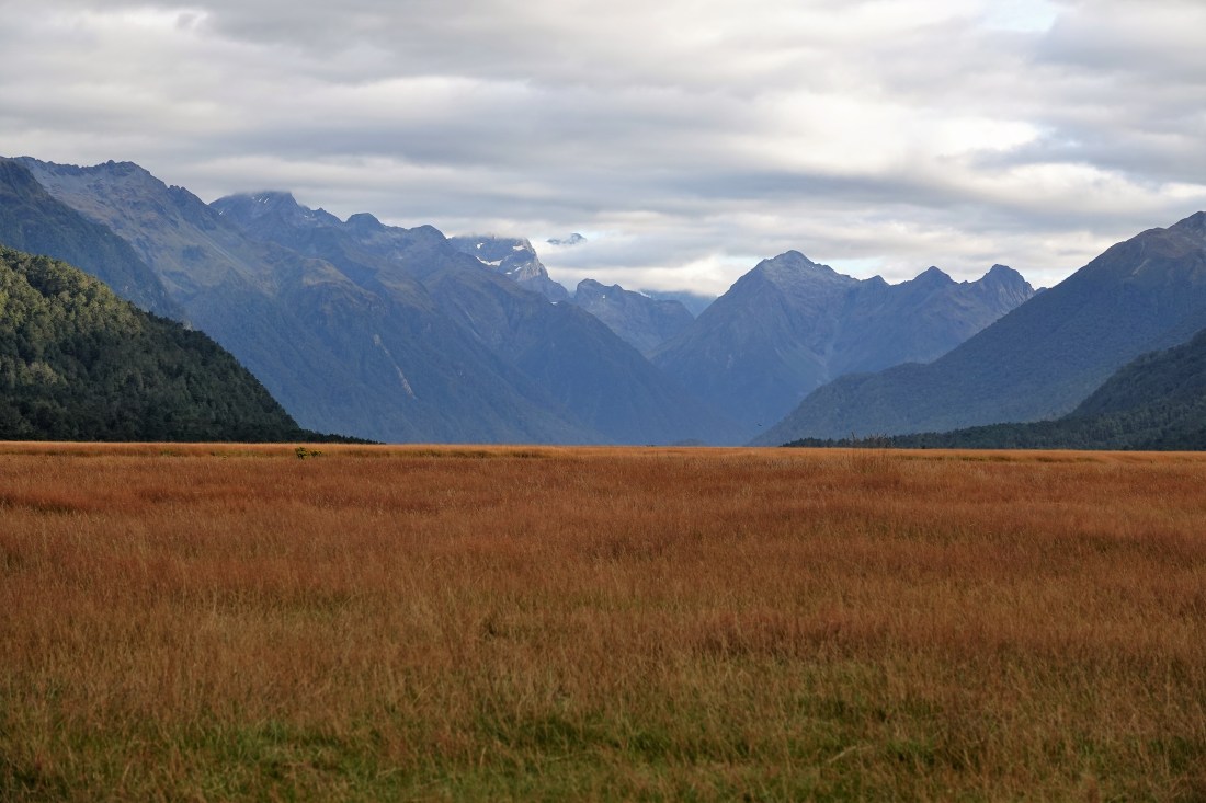
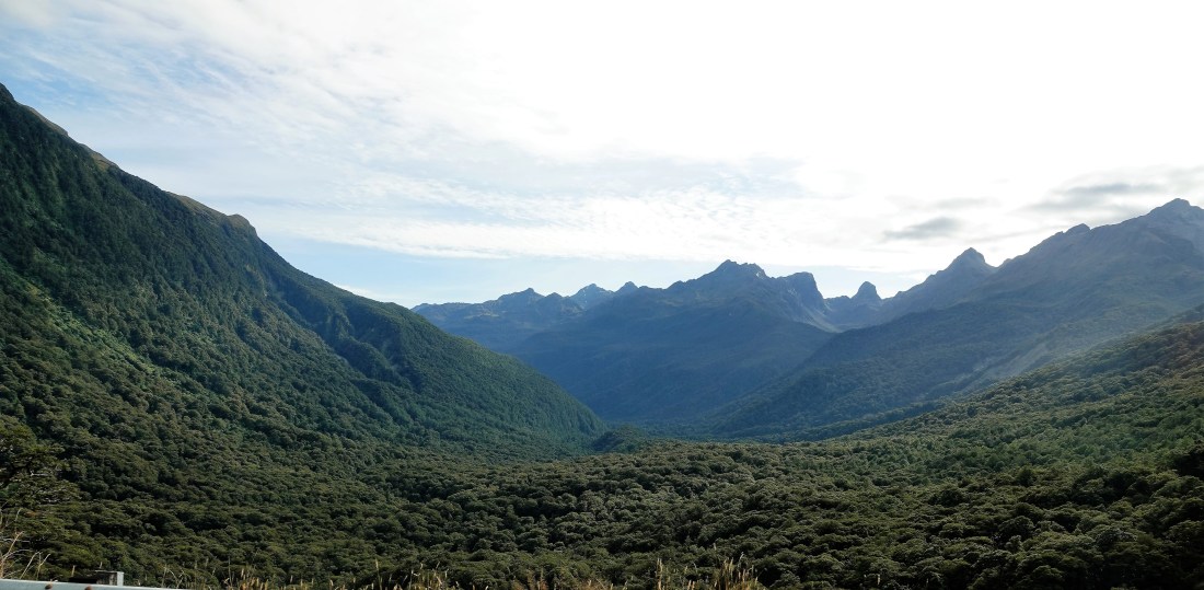
The rest of the views had to be taken from the bus, so please excuse the less-than-perfect standard. We were not allowed to stop once in the convoy, so it was a case of getting what I could. I did reckon that if I had been driving we would never have made it to the cruise in time as we would have had to stop around every corner for another breathtaking view. Not surprisingly, the whole area makes frequent appearances in Hobbit and Lord of the Rings films.

A quick word about the highway (74 miles from Te Anau), which was first surveyed in 1890, but work didn’t start until 1935 when ‘a rough road was constructed to the entrance of what would become Homer Tunnel. The tunnel itself was excavated by pick and shovel, mostly by workers directed there by the government during the Great Depression. Life for the workers was harsh and avalanches claimed 3 lives in the mid-1930s. While the breakthrough was achieved in February 1940, the labour shortage caused by World War II caused significant delays, and it was not until 1953 that the tunnel was finally completed.’ The tunnel itself is 1.27 km long and runs down at a gradient of 1:10, so you really emerge on the other side of the mountain range.
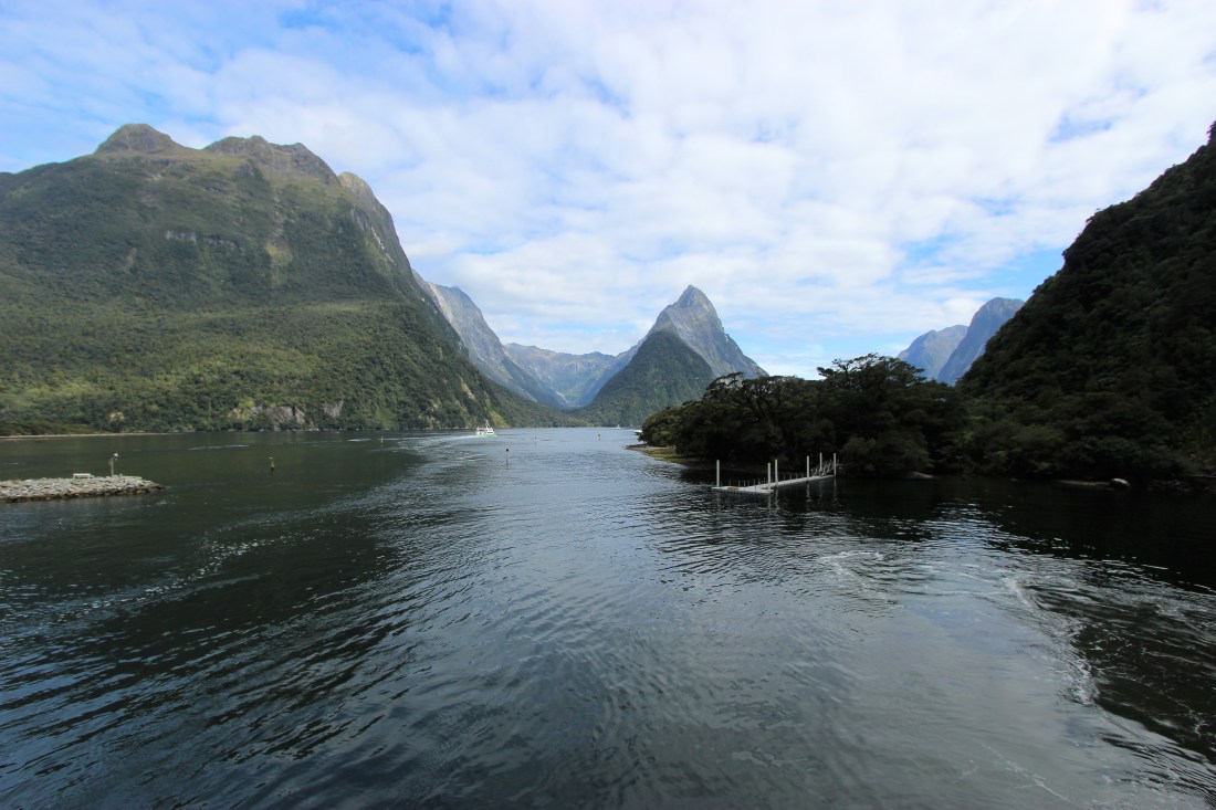
We wound down the last few kilometres to Milford Sound, where, to be honest, there is very little indeed other than a big pier with about 15 boats all waiting for the convoy to arrive. There is a small hotel, but nothing much else. Total population: about 120 – mostly employed in tourism.
OK, over to Wikipedia for those of you who wish to know more:
Milford Sound was initially overlooked by European explorers, because its narrow entry did not appear to lead into such large interior bays. Sailing ship captains such as James Cook, who bypassed Milford Sound on his journeys for just this reason, also feared venturing too close to the steep mountainsides, afraid that wind conditions would prevent escape. The fiord was a playground for local Maori who had acquired a large amount of local marine knowledge including tidal patterns and fish feeding patterns over generations prior to European arrival. The fiord remained undiscovered by Europeans until Captain John Grono discovered it c.1812 and named it Milford Haven after his homeland in Wales. Captain John Lort Stokes later renamed Milford Haven as Milford Sound.
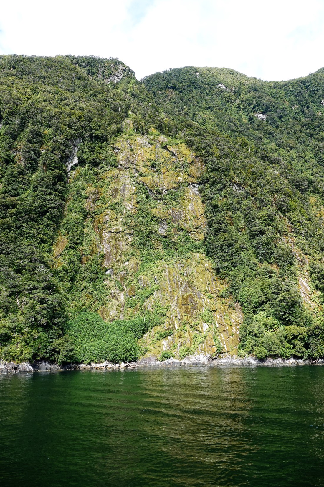
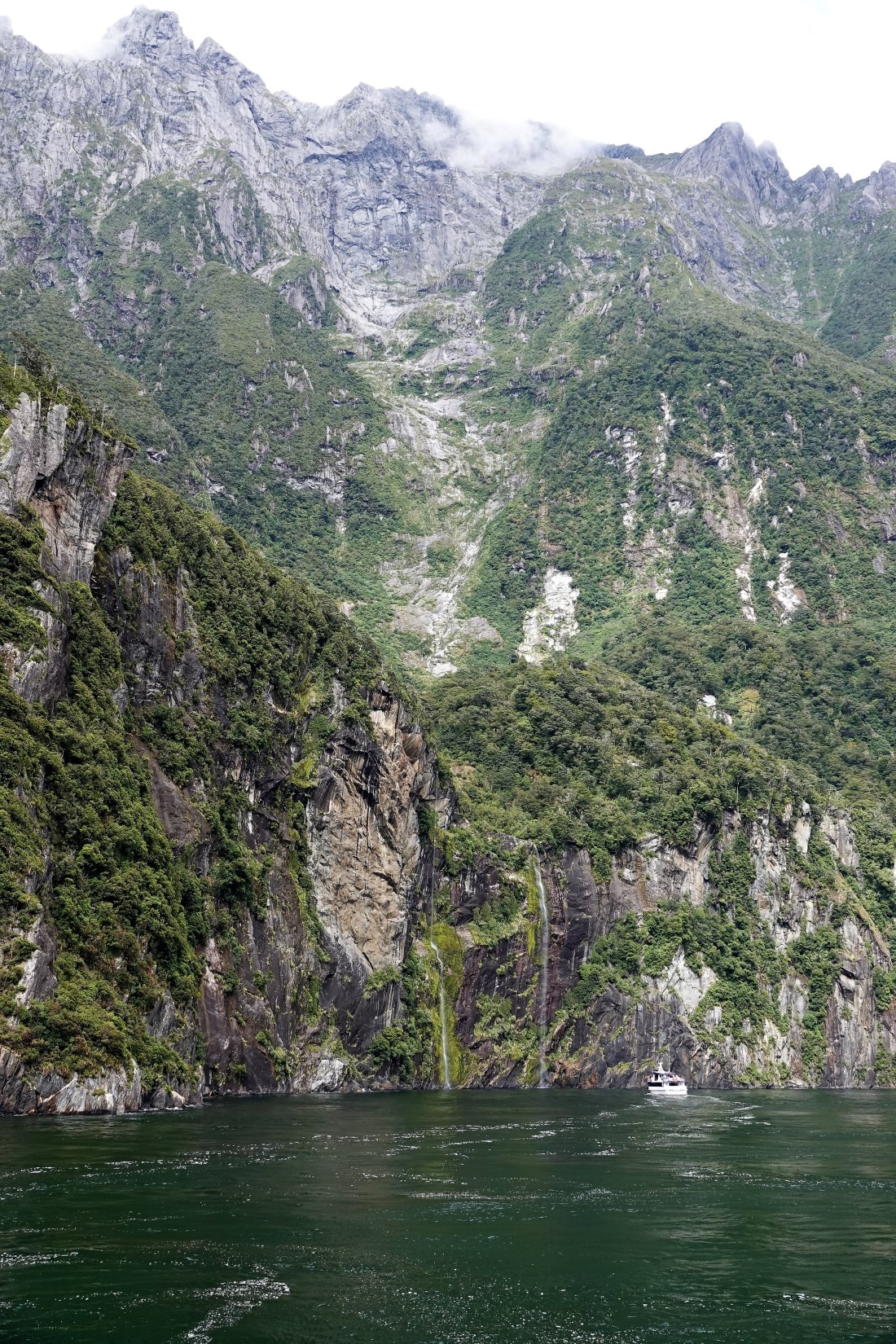
With a mean annual rainfall of 6,412 mm (252 in) each year, a high level even for the West Coast, Milford Sound is known as the wettest inhabited place in New Zealand and one of the wettest in the world. Rainfall can reach 250 mm (10 in) during a span of 24 hours. The rainfall creates dozens of temporary waterfalls (as well as a number of major, more permanent ones) cascading down the cliff faces, some reaching a thousand metres in length. Smaller falls from such heights may never reach the bottom of the sound, drifting away in the wind.
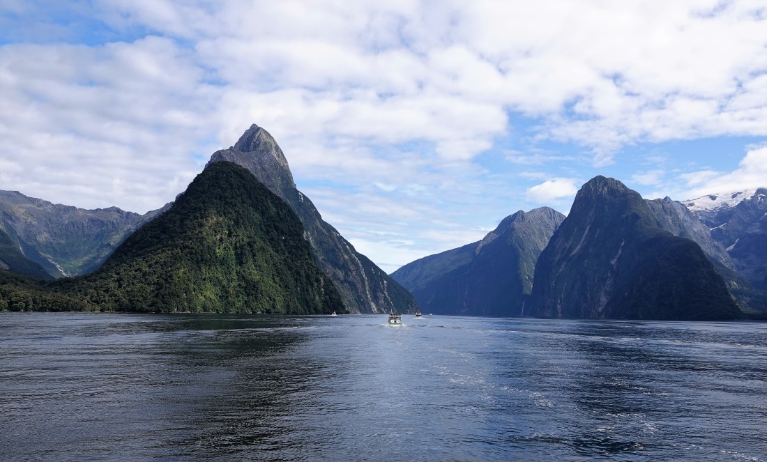
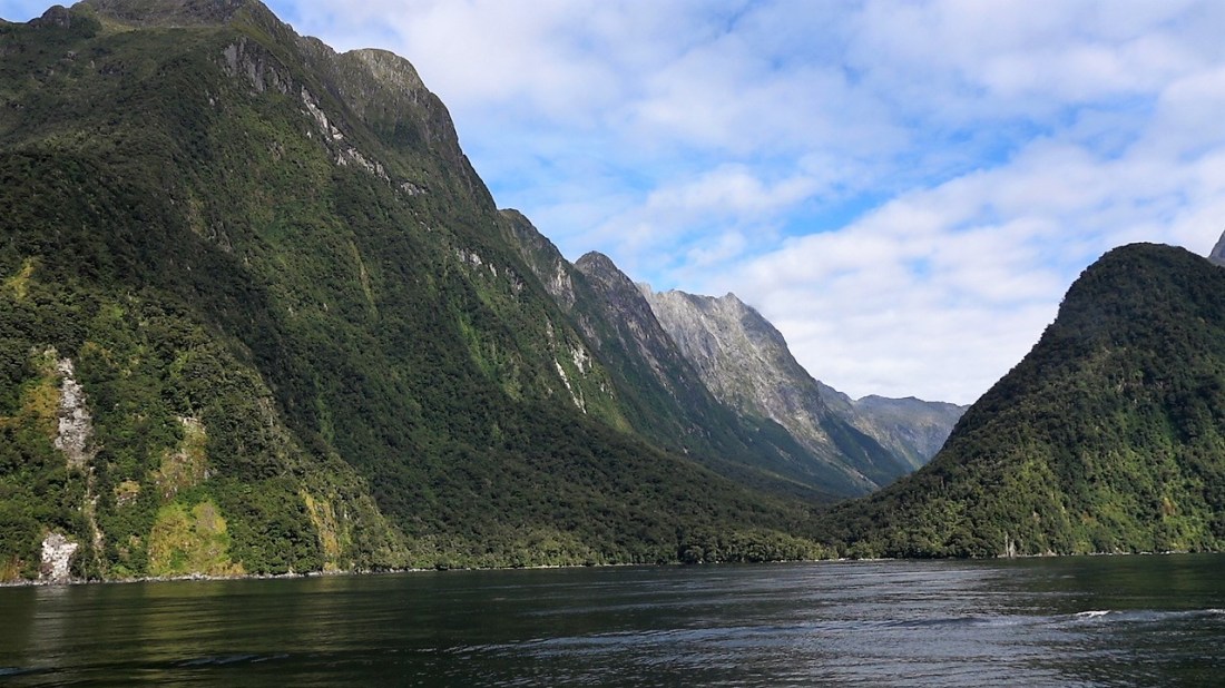
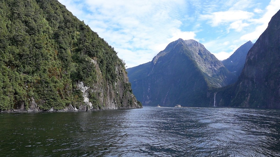
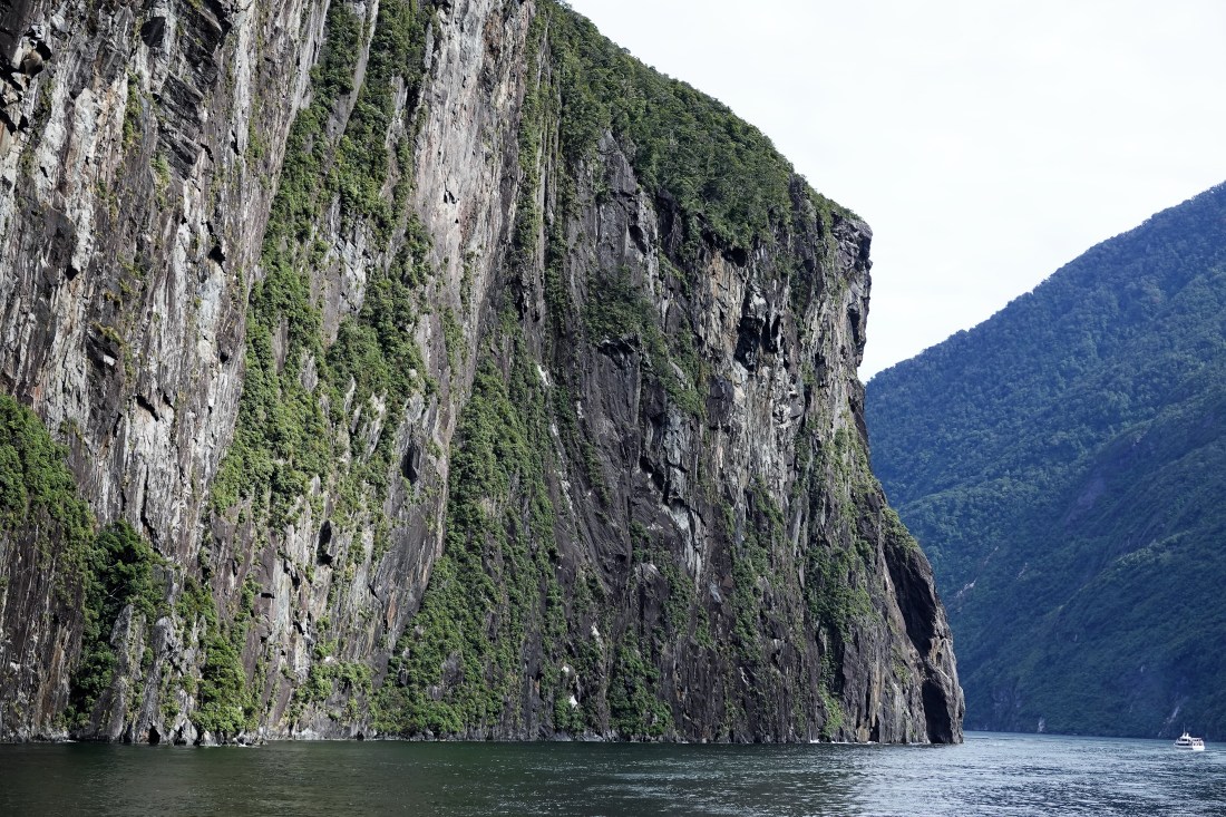
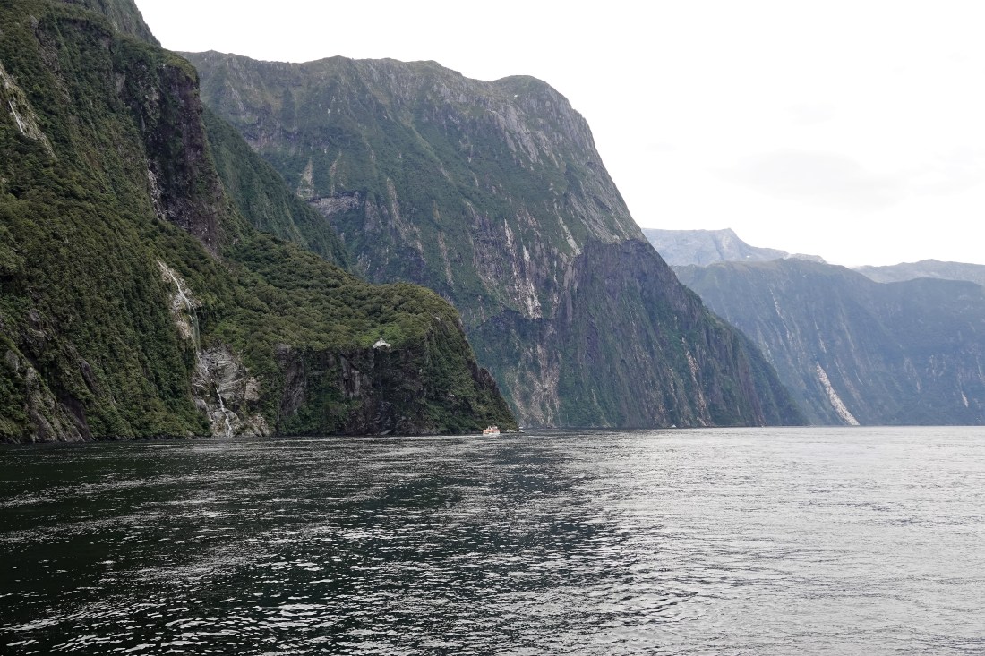
Milford Sound runs 15 kilometres inland from the Tasman Sea at Dale Point (also named after a location close to Milford Haven in Wales)—the mouth of the fiord—and is surrounded by sheer rock faces that rise 1,200 metres (3,900 ft) or more on either side. Among the peaks are The Elephant at 1,517 metres (4,977 ft), said to resemble an elephant’s head, and The Lion, 1,302 metres (4,272 ft), in the shape of a crouching lion.
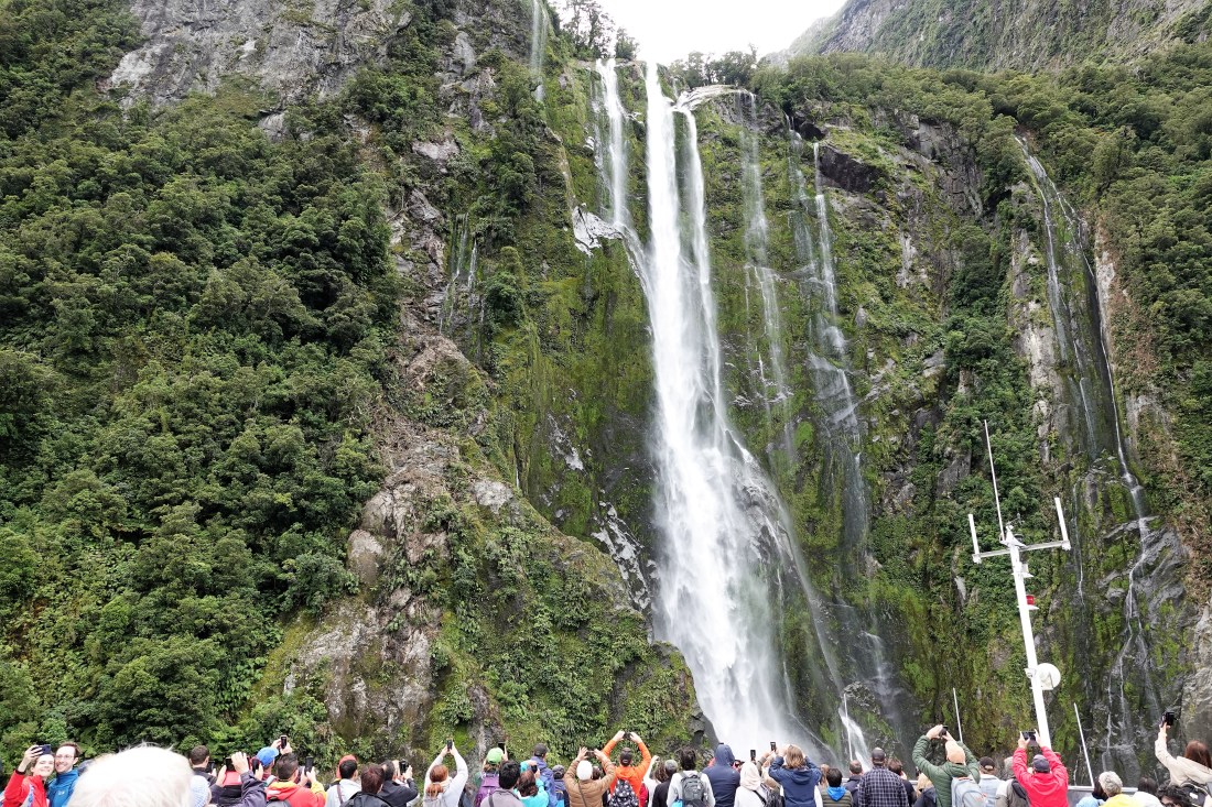
Milford Sound sports two permanent waterfalls, Lady Bowen Falls and Stirling Falls. After heavy rain temporary waterfalls can be seen running down the steep sided rock faces that line the fiord. They are fed by rain water drenched moss and will last a few days at most once the rain stops.
We quickly boarded our vessel and followed the other boats out into the Sound and yes, it is spectacular. I have done my best to show the height and steepness of the cliffs by ensuring a boat is in the picture. You will note that we were also lucky with the weather, though they say that you should also come when it is raining to get the full effect of the waterfalls.
And here are the photos:

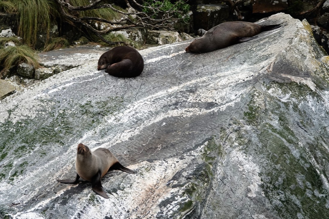
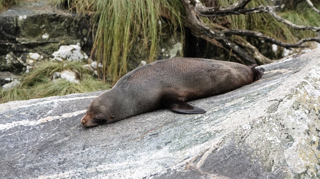
And though the seabirds were a bit scarce, we did see some seals!!
And one final waterfall near the pier…
All in all, FANtastic and well worth the long drive there. At least I didn’t have to do the driving this time. The journey back was equally pleasant, with just the one photo..

We collapsed back at the motel, had a good supper, again and slept well before our next exciting adventure tomorrow in Queenstown.
More soon!

How beautiful! I am very envious – however the photos are just fabulous. Thanks John!
LikeLike